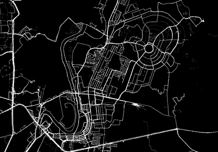
Current approaches to construct road network maps from GPS trajectories suffer from low precision, especially in dense urban areas and in regions with complex topologies such as overpasses and underpasses, parallel roads, and stacked roads. This paper proposes a two-stage method to improve precision without sacrificing recall (coverage).
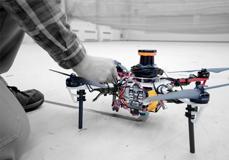
MIT researchers describe an autonomous system for a fleet of drones to collaboratively search under dense forest canopies. The drones use only onboard computation and wireless communication — no GPS required.
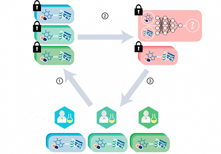
MIT researchers have developed a cryptographic system that could help neural networks identify promising drug candidates in massive pharmacological datasets, while keeping the data private.
MIT researchers have built a system that takes a step toward fully automated smart home by identifying occupants, even when they’re not carrying mobile devices. The system, called Duet, uses reflected wireless signals to localize individuals.